
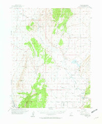
1950 Map of Enoch
USGS Topo · Published 1957About this map
The Cedar Valley is the focal point of this 1950s survey, illustrating the agricultural and industrial foundations of eastern Iron County. The settlement of Enoch stands at the foot of the Hurricane Cliffs, while the surrounding landscape is marked by historic locations such as Fort Johnson and the abandoned village of Stevensville. The map captures a transition from livestock ranching at Adams Ranch and Leigh Farm to the heavy industry represented by the Union Pacific rail lines and the mining activity near Iron Springs.
Find a feature on this map
39 named features on this map. Tap any name to fly to it.
Don’t see what you’re looking for? This feature index may not catch every label — zoom into the map to look around manually.
Map Details
Editions of this 1950 Enoch Map
2 editions found
Other maps of this area

1885 · St. George
USGS Topo · 1:250,000

1885 · Beaver
USGS Topo · 1:250,000

1886 · Kanab
USGS Topo · 1:250,000

1891 · St. George
USGS Topo · 1:250,000

1949 · Cedar City NW
USGS Topo · 1:24,000

1950 · Cedar City NW
USGS Topo · 1:24,000

1950 · Enoch
USGS Topo · 1:24,000

1950 · Cedar City
USGS Topo · 1:24,000

1950 · Iron Mountain
USGS Topo · 1:62,500

1950 · Cedar City
USGS Topo · 1:62,500