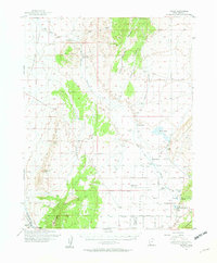
1950 Map of Enoch
USGS Topo · Published 1957About this map
The settlement of Enoch and the surrounding high desert terrain anchor this mid-century survey of Iron County. To the south, the Union Pacific line cuts across the landscape near Iron Springs, marking a critical transportation corridor for the region's agricultural and mining interests. The map reveals a series of established ranching operations and farmsteads, including Adams Ranch, Leigh Farm, and Clark Ranch, which suggest a distributed rural economy dependent on local water sources like Johnson Creek and Rush Lake.
Find a feature on this map
42 named features on this map. Tap any name to fly to it.
Don’t see what you’re looking for? This feature index may not catch every label — zoom into the map to look around manually.
Map Details
Editions of this 1950 Enoch Map
2 editions found
Other maps of this area

1885 · St. George
USGS Topo · 1:250,000

1885 · Beaver
USGS Topo · 1:250,000

1886 · Kanab
USGS Topo · 1:250,000

1891 · St. George
USGS Topo · 1:250,000

1949 · Cedar City NW
USGS Topo · 1:24,000

1950 · Cedar City NW
USGS Topo · 1:24,000

1950 · Enoch
USGS Topo · 1:24,000

1950 · Cedar City
USGS Topo · 1:24,000

1950 · Enoch
USGS Topo · 1:62,500

1950 · Iron Mountain
USGS Topo · 1:62,500