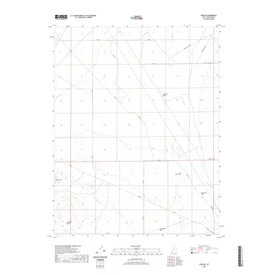
2020 Map of Avon SE
USGS Topo · Published 2020About this map
Escalante Desert dominates this section of Iron County, where the arid landscape is defined by drainage patterns and volcanic uplands. The terrain transitions from the open desert floor into the elevations of the Antelope Range and the prominent formation known as Three Peaks. This 2020 survey illustrates a grid-based road system that services the high desert, including long stretches of Avon Rd and Williat Rd that cut through the sage and scrub. Water is a scarce but defining element here, marked by the courses of Iron Springs Cr, Big Hollow Wash, and Dick-Palmer Wash. These ephemeral waterways and the presence of names like Water Hole Loop E point to the historic importance of reliable water sources in an otherwise parched environment. Notable landmarks such as Tucker Point and Upper Point provide orientation across the vast, open reaches of the Great Basin.
Find a feature on this map
21 named features on this map. Tap any name to fly to it.
Don’t see what you’re looking for? This feature index may not catch every label — zoom into the map to look around manually.
Map Details
Editions of this 2020 Avon SE Map
This is the sole edition of this map. No revisions or reprints were ever made.
Other maps of this area

1885 · St. George
USGS Topo · 1:250,000

1891 · St. George
USGS Topo · 1:250,000

1949 · Cedar City NW
USGS Topo · 1:24,000

1950 · Cedar City NW
USGS Topo · 1:24,000

1950 · Antelope Peak
USGS Topo · 1:24,000

1950 · Enoch
USGS Topo · 1:62,500

1950 · Iron Mountain
USGS Topo · 1:62,500

1950 · Cedar City
USGS Topo · 1:62,500

1950 · The Three Peaks
USGS Topo · 1:24,000

1950 · Silver Peak
USGS Topo · 1:24,000