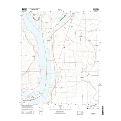
2015 Map of Avon
USGS Topo · Published 2015About this map
Mississippi River dynamics define this borderland where Kentucky Bend and Bell Island sit tucked within tight oxbow curves. The landscape is a complex network of active water and remnant channels, including Longwood Chute, Cornfield Chute, and Granny Baker Bayou. On the eastern bank in Washington County, the small settlements of Avon, James, and Longwood are connected by a grid of agricultural roads like Riverside Rd and Possum Ridge Rd.
Find a feature on this map
57 named features on this map. Tap any name to fly to it.
Don’t see what you’re looking for? This feature index may not catch every label — zoom into the map to look around manually.
Map Details
Editions of this 2015 Avon Map
This is the sole edition of this map. No revisions or reprints were ever made.
Other maps of this area

1939 · Readland
USGS Topo · 1:62,500

1939 · Refuge
USGS Topo · 1:62,500

1939 · Tralake
USGS Topo · 1:62,500

1939 · Swan Lake
USGS Topo · 1:62,500

1953 · Greenwood
USGS Topo · 1:250,000

1956 · Greenwood
USGS Topo · 1:250,000

1967 · Arcola
USGS Topo · 1:24,000
1967 · Swan Lake NW
USGS Topo · 1:24,000
1967 · Percy
USGS Topo · 1:24,000
1969 · Swan Lake
USGS Topo · 1:62,500