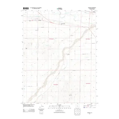
2013 Map of Avondale
USGS Topo · Published 2013About this map
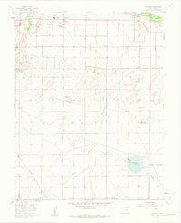
Arkansas River and Huerfano River bottomlands define the agricultural geography of this Pueblo County landscape. The settlement of Avondale serves as a central hub, flanked by the site of Fort Reynolds and the town of Boone to the northeast. This 2013 record illustrates the complex irrigation network vital to the High Plains, featuring the Bessemer Ditch, Welton Ditch, and the Colorado Canal snaking through the valley. Local history is anchored by the San Jose Church and its accompanying Cemetery, situated near the confluence of the river systems. The terrain transitions from the river flats to the elevated Badger Hills in the west and Hooker Hills in the south, while a grid of named rural routes like Autobees Rd and Huckleberry Rd provides access to scattered farmsteads and the banks of Lodge Lake.
Find a feature on this map
46 named features on this map. Tap any name to fly to it.
Don’t see what you’re looking for? This feature index may not catch every label — zoom into the map to look around manually.
Map Details
Editions of this 2013 Avondale Map
This is the sole edition of this map. No revisions or reprints were ever made.
Other maps of this area

1891 · Nepesta
USGS Topo · 1:125,000

1893 · Nepesta
USGS Topo · 1:125,000

1904 · Nepesta
USGS Topo · 1:125,000

1954 · Pueblo
USGS Topo · 1:250,000

1957 · Pueblo
USGS Topo · 1:250,000

1958 · Pueblo
USGS Topo · 1:250,000
1959 · Flying A Ranch
USGS Topo · 1:24,000
1960 · Nepesta
USGS Topo · 1:24,000
1960 · Boone Hill
USGS Topo · 1:24,000
1960 · Vineland
USGS Topo · 1:24,000