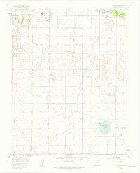
1960 Map of Vineland
USGS Topo · Published 1962About this map
Agricultural development in Pueblo Co is defined by an intricate network of irrigation, most notably the Bessemer Ditch that winds through the northern landscape. The settlement of Vineland serves as a local hub, characterized by a concentration of civic life including the Vineland Ch, Elementary Sch, and Pueblo Co Jr High Sch. This 1960 field check reveals a community organized around a grid of named thoroughfares like Jersey Road and Iris Road, reflecting the planned expansion of rural Colorado at mid-century.
Find a feature on this map
24 named features on this map. Tap any name to fly to it.
Don’t see what you’re looking for? This feature index may not catch every label — zoom into the map to look around manually.
Map Details
Editions of this 1960 Vineland Map
2 editions found
Other maps of this area

1891 · Pueblo
USGS Topo · 1:125,000

1891 · Nepesta
USGS Topo · 1:125,000

1893 · Nepesta
USGS Topo · 1:125,000

1894 · Pueblo
USGS Topo · 1:125,000

1896 · Pueblo
USGS Topo · 1:125,000

1897 · Pueblo
USGS Topo · 1:125,000

1904 · Nepesta
USGS Topo · 1:125,000

1954 · Pueblo
USGS Topo · 1:250,000

1957 · Pueblo
USGS Topo · 1:250,000

1958 · Pueblo
USGS Topo · 1:250,000