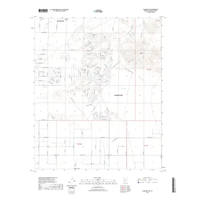
2018 Map of Avondale SW
USGS Topo · Published 2018About this map
The Gila River corridor defines the northern edge of this Maricopa County landscape, where the fertile soils of Buckeye Valley meet the rising slopes of the Sierra Estrella mountains. In this contemporary survey, the expansion of Buckeye and Goodyear is evident in the transition from traditional irrigation infrastructure, like the S Extension Canal, to the sprawling modern street networks pushing southward. Genealogists may find interest in the Liberty Cem located near the northern boundary, a site that remains as a landmark of the area's early agricultural community. Further south, the terrain gives way to the drainage systems of Corgett Wash and Lum Wash as they cut through the floor of Rainbow Valley. The map documents a specific moment of urban growth as residential developments move into the arid reaches of the Sonoran Desert.
Find a feature on this map
107 named features on this map. Tap any name to fly to it.
Don’t see what you’re looking for? This feature index may not catch every label — zoom into the map to look around manually.
Map Details
Editions of this 2018 Avondale SW Map
This is the sole edition of this map. No revisions or reprints were ever made.
Other maps of this area

1946 · Avondale
USGS Topo · 1:62,500

1948 · Cashion
USGS Topo · 1:62,500

1951 · Mobile
USGS Topo · 1:62,500

1951 · Cotton Center
USGS Topo · 1:62,500

1954 · Phoenix
USGS Topo · 1:250,000

1957 · Phoenix
USGS Topo · 1:250,000

1957 · Valencia
USGS Topo · 1:24,000

1957 · Perryville
USGS Topo · 1:24,000

1957 · Tolleson
USGS Topo · 1:24,000

1957 · Avondale SW
USGS Topo · 1:24,000