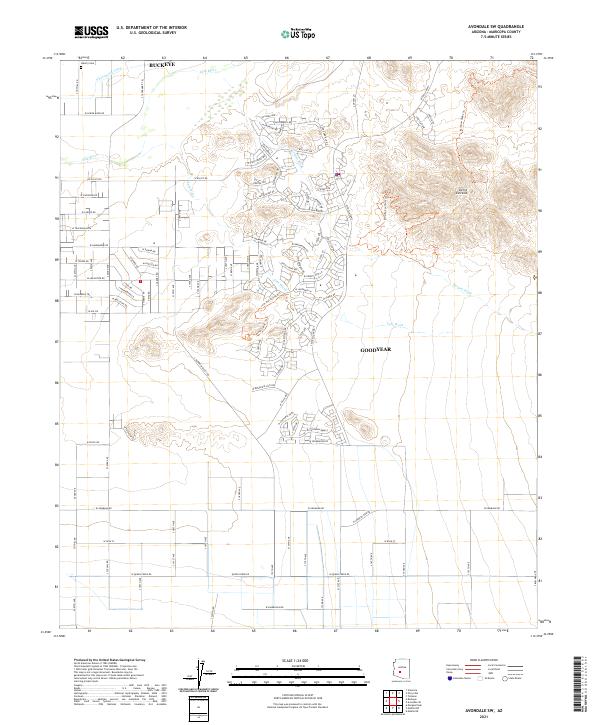
2021 Map of Avondale SW
USGS Topo · Published 2021About this map
The Gila River corridor south of Buckeye defines this modern topographical landscape, where agricultural tradition meets suburban expansion. North of the river, the S Extension Canal and Liberty Cem mark long-established land use near the northern boundary. The terrain shifts dramatically to the southeast, where the rising peaks of the Sierra Estrella dominate the horizon. Between the mountains and the river, the expanding residential footprints of Goodyear are visible, interlaced with desert drainage systems like Lum Wash and Corgett Wash. The presence of W Telegram Path and the Rainbow Valley Trl indicates the area's transition from open range and valley floor to a developed corridor, while the underlying PLSS grid sections like t1s r2w provide a structural reference for property research.
Find a feature on this map
105 named features on this map. Tap any name to fly to it.
Don’t see what you’re looking for? This feature index may not catch every label — zoom into the map to look around manually.
Map Details
Editions of this 2021 Avondale SW Map
This is the sole edition of this map. No revisions or reprints were ever made.
Other maps of this area

1946 · Avondale
USGS Topo · 1:62,500

1948 · Cashion
USGS Topo · 1:62,500

1951 · Mobile
USGS Topo · 1:62,500

1951 · Cotton Center
USGS Topo · 1:62,500

1954 · Phoenix
USGS Topo · 1:250,000

1957 · Phoenix
USGS Topo · 1:250,000

1957 · Valencia
USGS Topo · 1:24,000

1957 · Perryville
USGS Topo · 1:24,000

1957 · Tolleson
USGS Topo · 1:24,000

1957 · Avondale SW
USGS Topo · 1:24,000