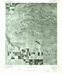
1971 Map of Avondale SW
USGS Topo · Published 1972About this map
The Sierra Estrella mountains dominate the eastern skyline of this 1971 orthophotomosaic, casting long shadows over the desert floor where the Gila River cuts through the northern reaches. This aerial perspective, captured by the Geological Survey, reveals a stark transition between the arid, drainage-scarred lowlands and the structured geometry of early 1970s agriculture. The southern half of the map shows a developed grid of irrigated fields that abruptly meet the desert scrub at the base of the mountains. Seasonal drainages like Waterman Wash and Corgett Wash wind across the landscape, illustrating the natural flow patterns that dictated the placement of early Maricopa County homesteads and farms before more intensive suburban expansion reached this part of the valley.
Find a feature on this map
4 named features on this map. Tap any name to fly to it.
Don’t see what you’re looking for? This feature index may not catch every label — zoom into the map to look around manually.
Map Details
Editions of this 1971 Avondale SW Map
This is the sole edition of this map. No revisions or reprints were ever made.
Other maps of this area

1946 · Avondale
USGS Topo · 1:62,500

1948 · Cashion
USGS Topo · 1:62,500

1951 · Mobile
USGS Topo · 1:62,500

1951 · Cotton Center
USGS Topo · 1:62,500

1954 · Phoenix
USGS Topo · 1:250,000

1957 · Phoenix
USGS Topo · 1:250,000

1957 · Valencia
USGS Topo · 1:24,000

1957 · Perryville
USGS Topo · 1:24,000

1957 · Tolleson
USGS Topo · 1:24,000

1957 · Avondale SW
USGS Topo · 1:24,000