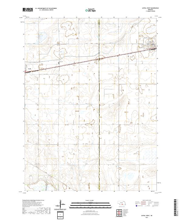
2021 Map of Axtell West
USGS Topo · Published 2021About this map
Fridhem Cem sits along the southern border of Kearney County, marking a historic point of reference in this agricultural corridor of south-central Nebraska. The landscape is defined by the steady grid of section lines and the Tri-County railroad line that links the small grain-elevator settlements of Axtell and Funk. While the terrain appears flat, the presence of Dry Creek and various seasonal wetland depressions suggests a subtle hydrology that influenced early homesteading and road placement.
Find a feature on this map
40 named features on this map. Tap any name to fly to it.
Don’t see what you’re looking for? This feature index may not catch every label — zoom into the map to look around manually.
Map Details
Editions of this 2021 Axtell West Map
This is the sole edition of this map. No revisions or reprints were ever made.
Other maps of this area

1894 · Kearney
USGS Topo · 1:62,500

1896 · Holdrege
USGS Topo · 1:125,000

1896 · Kearney
USGS Topo · 1:125,000

1955 · Grand Island
USGS Topo · 1:250,000

1957 · Grand Island
USGS Topo · 1:250,000

1958 · Grand Island
USGS Topo · 1:250,000

1970 · Holdrege East
USGS Topo · 1:24,000

1970 · Axtell West
USGS Topo · 1:24,000
1970 · Kearney SE
USGS Topo · 1:24,000
1970 · Axtell East
USGS Topo · 1:24,000