
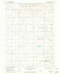
1970 Map of Holdrege East
USGS Topo · Published 1972About this map
Holdrege serves as a major hub for Phelps County during the early 1970s, with its urban grid centered on the Courthouse and education anchored by High Sch and Lincoln Sch. The surrounding landscape is a productive agricultural expanse divided by the Burlington Northern railroad, which links the county seat to the smaller village of Funk. Water management is central to this prairie environment, evidenced by the large Phelps County Canal and the winding Sacramento Creek. Local history is preserved in several rural burial grounds, including the Prairie Home Cemetery and Bethel Cem. To the south and east, the Sacramento-Wilcox State Wildlife Management Area and the waters of Prairie Lake mark a shift from managed farmland to conservation and drainage basins, while smaller landmarks like School No 7 and various radio towers highlight the dispersed nature of the mid-century Nebraska plains.
Find a feature on this map
22 named features on this map. Tap any name to fly to it.
Don’t see what you’re looking for? This feature index may not catch every label — zoom into the map to look around manually.
Map Details
Editions of this 1970 Holdrege East Map
This is the sole edition of this map. No revisions or reprints were ever made.
Other maps of this area

1894 · Kearney
USGS Topo · 1:62,500

1896 · Holdrege
USGS Topo · 1:125,000

1896 · Kearney
USGS Topo · 1:125,000

1955 · Grand Island
USGS Topo · 1:250,000

1957 · Grand Island
USGS Topo · 1:250,000

1958 · Grand Island
USGS Topo · 1:250,000

1970 · Axtell West
USGS Topo · 1:24,000
1970 · Elm Creek SE
USGS Topo · 1:24,000

1970 · Wilcox
USGS Topo · 1:24,000

1970 · Ragan
USGS Topo · 1:24,000
Featured Places
- Holdrege, NE
- Funk, NE
- Sacramento, NE
- Westside Plaza Mobile Home Park, Holdrege
- Dewaynes Trailer Court, Holdrege