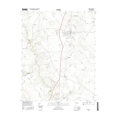
2016 Map of Ayden
USGS Topo · Published 2016About this map
Ayden and the neighboring community of Winterville anchor the northern reaches of this landscape, where the agricultural plains of eastern North Carolina meet the winding waterways of the Coastal Plain. The map documents a complex network of rural crossroads and established settlements, including Grifton and Scuffleton, positioned near the convergence of Pitt, Greene, and Lenoir counties. The terrain is defined by the drainage systems of Contentnea Creek and Swift Creek, which meander through a patchwork of timbered lowlands and farmed fields.
Find a feature on this map
113 named features on this map. Tap any name to fly to it.
Don’t see what you’re looking for? This feature index may not catch every label — zoom into the map to look around manually.
Map Details
Editions of this 2016 Ayden Map
This is the sole edition of this map. No revisions or reprints were ever made.
Other maps of this area

1902 · Ayden
USGS Topo · 1:62,500

1903 · Winterville
USGS Topo · 1:62,500

1904 · Ayden
USGS Topo · 1:62,500

1904 · Falkland
USGS Topo · 1:62,500

1905 · Winterville
USGS Topo · 1:62,500

1914 · Kinston
USGS Topo · 1:48,000

1916 · Kinston
USGS Topo · 1:62,500

1953 · Rocky Mount
USGS Topo · 1:250,000

1954 · Rocky Mount
USGS Topo · 1:250,000
1981 · Farmville
USGS Topo · 1:24,000