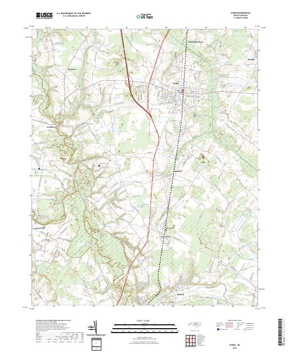
2022 Map of Ayden
USGS Topo · Published 2022About this map
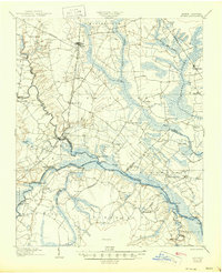
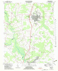
Little Contentnea Creek and the larger Contentnea Creek define the low-lying geography of this eastern North Carolina landscape, where the borders of Pitt, Greene, and Lenoir counties converge. The town of Ayden serves as the primary hub, showing a well-developed street grid including Park Ave and Washington St, while surrounding rural communities such as Scuffleton, Hanrahan, and Rountree maintain their distinct identities amidst the agricultural plains. For genealogists, the map preserves the locations of family-named sites like Jackson Cem and Artis Cem. The southern edge of the map reaches the community of Grifton, situated along the winding riverbanks. The drainage patterns of Swift Cr and its tributaries reveal the importance of water management in this coastal plain region, illustrating a landscape shaped by both its natural waterways and a network of rural roads like Jolly Rd and Old Tar Rd.
Find a feature on this map
130 named features on this map. Tap any name to fly to it.
Don’t see what you’re looking for? This feature index may not catch every label — zoom into the map to look around manually.
Map Details
Editions of this 2022 Ayden Map
This is the sole edition of this map. No revisions or reprints were ever made.
Historical Maps of Pleasant Ridge Through Time
4 maps found