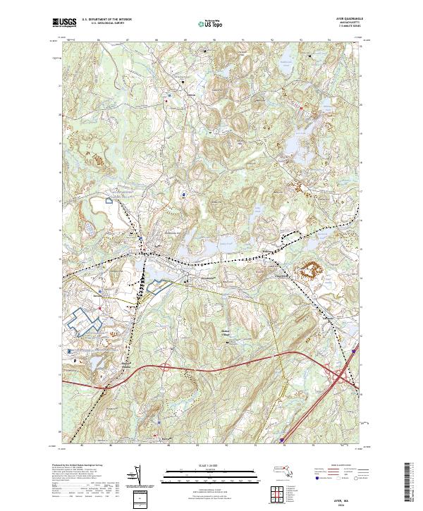
2024 Map of Ayer
USGS Topo · Published 2024About this map
The Nashua River corridor serves as the central artery for this part of Middlesex County, where the industrial legacy of Ayer and the residential character of Groton meet. The landscape is defined by a series of prominent glacial hills, including Gibbet Hill and Nonaicoicus Hill, which rise above a complex network of wetlands like Burnt Meadow Swamp and Carmichael Swamp. To the south, the expansive Devens Reserve Forces Tng Area occupies a significant portion of the terrain, reflecting the long military presence in the area.
Find a feature on this map
98 named features on this map. Tap any name to fly to it.
Don’t see what you’re looking for? This feature index may not catch every label — zoom into the map to look around manually.
Map Details
Editions of this 2024 Ayer Map
This is the sole edition of this map. No revisions or reprints were ever made.
Other maps of this area

1886 · Lowell
USGS Topo · 1:62,500

1886 · Framingham
USGS Topo · 1:62,500

1887 · Marlboro
USGS Topo · 1:62,500

1889 · Marlboro
USGS Topo · 1:62,500

1889 · Framingham
USGS Topo · 1:62,500

1893 · Lowell
USGS Topo · 1:62,500

1893 · Groton
USGS Topo · 1:62,500

1894 · Framingham
USGS Topo · 1:62,500

1896 · Marlboro
USGS Topo · 1:62,500

1898 · Marlboro
USGS Topo · 1:62,500