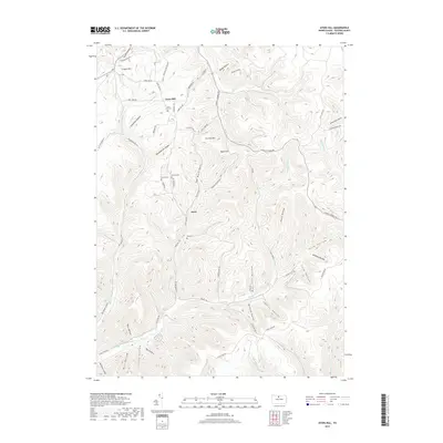
2019 Map of Ayers Hill
USGS Topo · Published 2019About this map
Ayers Hill and the crossroads at Borie anchor this Potter County landscape, where deep valleys and high ridges dictate the path of travel and settlement. The map documents a rugged terrain defined by a dense network of runs and hollows, including the curiously named The Black Hole and the extensive First Fork Sinnemahoning Cr in the southwest. For genealogists, the map is particularly valuable for its placement of isolated family and community burial grounds, such as Ayers Hill Cem, Anson Cem, and Jackson Cem, often situated near high points like Jenkins Hill. The drainage pattern is complex, with headwaters like W Br Pine Cr and Prouty Run carving through the plateau. A web of local roads, including Cherry Springs Rd and Big Moores Run Rd, follows the contours of the land, connecting these remote Potter County settlements.
Find a feature on this map
68 named features on this map. Tap any name to fly to it.
Don’t see what you’re looking for? This feature index may not catch every label — zoom into the map to look around manually.
Map Details
Editions of this 2019 Ayers Hill Map
This is the sole edition of this map. No revisions or reprints were ever made.
Other maps of this area

1932 · Genesee
USGS Topo · 1:62,500

1934 · Coudersport
USGS Topo · 1:48,000

1937 · Genesee
USGS Topo · 1:62,500

1938 · Coudersport
USGS Topo · 1:62,500

1947 · Conrad
USGS Topo · 1:62,500

1947 · Conrad
USGS Topo · 1:24,000

1947 · Short Run
USGS Topo · 1:24,000

1947 · Ayers Hill
USGS Topo · 1:24,000

1947 · Cherry Springs
USGS Topo · 1:24,000

1948 · Emporium
USGS Topo · 1:62,500
Featured Places
- Sweden Township, PA
- Homer Township, PA
- Ayers Hill, Homer Township
- Eulalia Township, PA
- Summit Township, PA