
1947 Map of Short Run
USGS Topo · Published 1956About this map
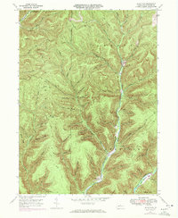
Cross Fork and the upper reaches of Kettle Creek define this heavily dissected landscape in northern Pennsylvania, where the borders of Summit, Abbott, Eulalia, and Stewardson townships meet. Mapping from 1945 aerial photography reveals a wilderness crossed by a network of historic pathways, including the Splash Dam Trail and Elk Lick Trail, suggesting a legacy of timber harvesting and remote travel.
Find a feature on this map
70 named features on this map. Tap any name to fly to it.
Don’t see what you’re looking for? This feature index may not catch every label — zoom into the map to look around manually.
Map Details
Editions of this 1947 Short Run Map
2 editions found
Other maps of this area

1943 · Hyner
USGS Topo · 1:62,500

1946 · Young Womans Creek
USGS Topo · 1:24,000

1946 · Renovo East
USGS Topo · 1:62,500

1946 · Renovo West
USGS Topo · 1:62,500

1946 · Hammersley Fork
USGS Topo · 1:24,000

1946 · Tamarack
USGS Topo · 1:24,000

1947 · Conrad
USGS Topo · 1:62,500

1947 · Galeton
USGS Topo · 1:62,500

1947 · Conrad
USGS Topo · 1:24,000

1947 · Ayers Hill
USGS Topo · 1:24,000
Featured Places
- Abbott Township, PA
- Wharton Township, PA
- Summit Township, PA
- Gravel Lick, Stewardson Township
- Stewardson Township, PA