Old Maps of Stewardson Township, Pennsylvania
Explore 61 old maps of Stewardson Township, spanning from 1943 to today. These high-resolution historic maps reveal how streets, neighborhoods, landmarks, and natural features evolved over time — perfect for genealogy, metal detecting, research, and local history exploration.
What you can do with these maps:
- See how Stewardson Township changed over time: Compare historical maps to modern-day views to trace roads, homesites, rail lines & more.
- View detailed metadata: Each map includes creators, publishers, year, scale, and archive source.
- Overlay maps with satellite & LiDAR: Visualize the past alongside modern tools to explore terrain & human change.
- Trusted historical sources: Maps sourced from the USGS, Library of Congress, and other archives.
- Access maps your way: View online, download high-res files, or order prints for personal or research use.
Start exploring old maps of Stewardson Township to uncover forgotten places, hidden landmarks, and the deep history beneath your feet.
Stewardson Township, PA maps
(61)- 1943 Map of Hyner
 1943 Hyner1943 Print · USGSIn the central Pennsylvania highlands during the mid-1940s, the river and rail lines dictated the life of the valley. Researchers can trace the industrial corridor from Renovo Boro to remote outposts like Slate Run and Young Womanstown.
 - 1946 Map of Young Womans Creek
 1946 Young Womans Creek1946 Print · USGSClinton County and the surrounding high ridges were deeply forested and sparsely settled in the late 1940s. Genealogists and historians can trace old timber and utility routes like the Underground Pipe Line, Greenlick Road, and the curiously named Bobsled Trail.4 unique versions available
 - 1946 Map of Renovo East, 1953 Print
 1946 Renovo East1953 Print · USGSThe industrial corridor of the West Branch Susquehanna River is seen here in the mid-1940s, showing the critical rail infrastructure of the Pennsylvania railroad. Genealogists can trace family sites in Gleasonton or Farwell and locate the St Josephs Cem.3 unique versions available
 - 1946 Map of Renovo West, 1953 Print
 1946 Renovo West1953 Print · USGSClinton County's river valleys and ridgelines come alive in this mid-century survey of the Pennsylvania wilds. Trace the industrial footprint of the Pennsylvania RR through Renovo or find family history at Laurel Hill Cem and Summerson Cem.9 unique versions available
 - 1946 Map of Tamarack, 1955 Print
 1946 Tamarack1955 Print · USGSClinton and Potter Counties appear in the mid-forties as a landscape of deep valleys and vital watershed headwaters. Genealogists and historians can trace the remote highlands surrounding Tamarack, locating local landmarks like Browns Mill and the Tamarack Lookout Tower.4 unique versions available
 - 1946 Map of Slate Run, 1958 Print
 1946 Slate Run1958 Print · USGSThe wilderness of Lycoming and Clinton counties comes into focus in the mid-1940s, highlighting the riverside rail economy and high-plateau landmarks. Genealogists and researchers can trace the New York Central railroad, the Slate Run settlement, and the Pump Station Fire Tower.4 unique versions available
 - 1947 Map of Conrad, 1952 Print
 1947 Conrad1952 Print · USGSPotter County’s timbered ridges and deep hollows are captured here just after the war, showing a rural landscape before modern development. Researchers can locate family cemeteries like Angell Cem and Reed Cem, or trace the old Jersey Shore Turnpike.4 unique versions available
 - 1947 Map of Galeton, 1953 Print
 1947 Galeton1953 Print · USGSThe Pennsylvania Wilds around Galeton are captured here just after the war, showing a deeply timbered landscape of mountain ridges and narrow hollows. Genealogists can locate family cemeteries like Phoenix Cem and the legendary ruins of Ole Bull Castle.3 unique versions available
 - 1947 Map of Lee Fire Tower, 1954 Print
 1947 Lee Fire Tower1954 Print · USGSTioga, Potter, and Lycoming counties meet in this 1940s survey of the Pennsylvania Wilds. Researchers can trace historic industrial and forestry landmarks including the Lee Fire Tower, the Clay Mine Trail, and a remote Gas Well along the Cushman Br.5 unique versions available
 - 1947 Map of Short Run, 1956 Print
 1947 Short Run1956 Print · USGSPotter County’s timbered ridges and deep hollows are documented here just after the war, showing the remote township corners and mountain trails. Trace family-named landmarks like Knickerbocker Hol and Yochum Run or find the early paths at Short Run.2 unique versions available
 - 1947 Map of Oleona, 1958 Print
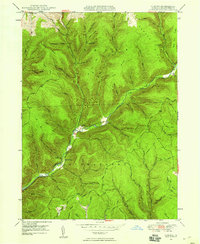 1947 Oleona1958 Print · USGSThe Potter County wilderness near the turn of the mid-century reveals the legacy of a famed Norwegian colony. Trace the sites of Ole Bull Castle (Ruins) and Oleona, or follow old paths like the Yochum Trail and Klondike Trail.3 unique versions available
 - 1948 Map of Tamarack
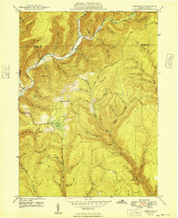 1948 Tamarack1948 Print · USGSThe northern reaches of Clinton County are captured here just after the war, showing a landscape defined by deep creek valleys and forest fire lookouts. Researchers can locate the Tamarack Lookout Tower, the Cem near Cross Fork, and the distinct boggy terrain of Tamarack Swamp.2 unique versions available
 - 1948 Map of Slate Run
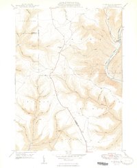 1948 Slate Run1948 Print · USGSThe Pine Creek Valley near the Lycoming and Clinton county line is shown here just after the war, when the New York Central railroad still served the riverside. Genealogists and hikers can trace the remote hollows and high points like the Pump Station Fire Tower and the Gorge near Slate Run.2 unique versions available
 - 1949 Map of Short Run
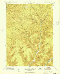 1949 Short Run1949 Print · USGSPotter County’s high plateaus and steep hollows are caught in fine detail during the late 1940s as forest roads began replacing old upland paths. Researchers can trace historic routes like the Splash Dam Trail and locate family-named landmarks such as Knickerbocker Hol and Bunnell Ridge.
 - 1949 Map of Young Womans Creek
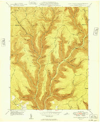 1949 Young Womans Creek1949 Print · USGSClinton and Potter Counties appear here in the late 1940s, showing a high-plateau landscape defined by timber history and infrastructure. Trace the network of old forest paths like Italian Trail and Lebo Road or the path of the Underground Pipe Line through the hollows.
 - 1950 Map of Lee Fire Tower
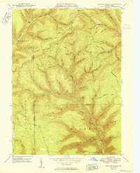 1950 Lee Fire Tower1950 Print · USGSThe Pennsylvania Wilds are captured here at mid-century, showcasing the rugged drainage basins where Potter, Tioga, and Lycoming counties meet. Genealogists and hikers can trace the old Randall Trail, locate the Lee Fire Tower, or find the historical Clay Mine.
 - 1950 Map of Oleona
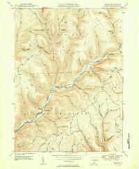 1950 Oleona1950 Print · USGSThe Potter County highlands in the mid-century appear here as a land of deep hollows and high ridges. Trace the ruins of a failed Norwegian colony at Ole Bull Castle (Ruins) and find family landmarks like Yochum Cem near Oleona.2 unique versions available
 - 1954 Map of Williamsport
 1954 Williamsport1954 Print · USGSNorth-central Pennsylvania in the mid-fifties is defined by the winding West Branch Susquehanna River and its industrial valley. Local historians can trace the massive Susquehanna Ordnance Depot and the extensive rail networks of the Pennsylvania Railroad.
 - 1960 Map of Williamsport
 1960 Williamsport1960 Print · USGSNorth-central Pennsylvania in the mid-twentieth century was a vital corridor of rail and river industry stretching from the New York line to the coal regions. Genealogists can trace the rail networks of the Pennsylvania RR and Lehigh Valley RR connecting towns like Williamsport, Towanda, and Lock Haven.
 - 1962 Map of Williamsport, 1966 Print
 1962 Williamsport1966 Print · USGSNorth-central Pennsylvania was a landscape of industrial river hubs and vast state woodlands in the early sixties. Researchers can trace the path of the Pennsylvania Railroad through Williamsport and explore the remote reaches of Bucktail State Park.5 unique versions available
 - 1965 Map of Williamsport
 1965 Williamsport1965 Print · USGSNorth-central Pennsylvania in the mid-1960s is defined by the industrial river towns and vast timberlands of the Allegheny Plateau. Researchers can trace historic rail lines like the Erie Lackawanna and Reading as they thread through Williamsport, Lock Haven, and Jersey Shore.
 - 1966 Map of Williamsport
 1966 Williamsport1966 Print · USGSThe Susquehanna Valley was a hub of transit and industry in the mid-seventies, where the river's West Branch connected major college towns and timberlands. Researchers can trace historical rail lines like the Reading or locate regional landmarks from Jersey Shore to Ricketts Glen State Park.
 - 1971 Map of Short Run, 1984 Print
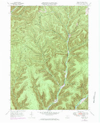 1971 Short Run1984 Print · USGSPotter County’s high Allegheny Plateau is captured here during the early 1970s, showcasing the isolated settlements and logging-era remnants of North Central Pennsylvania. Genealogists and hikers can trace old routes along the Splash Dam Trail or locate remote points like Elk Lick Knob and the small outpost at Abbott.
 - 1977 Map of Lee Fire Tower, 1979 Print
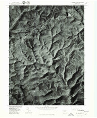 1977 Lee Fire Tower1979 Print · USGSTioga County's timbered highlands are captured in the late 1970s through high-altitude aerial photography. Researchers can trace the rugged drainage patterns of Cushman Branch and Francis Branch or locate the site of the Lee Fire Tower.
 - 1981 Map of Wellsboro, 1982 Print
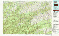 1981 Wellsboro1982 Print · USGSNorthern Pennsylvania in the early eighties shows a landscape of deep river gorges and vast state forests. Trace the rail lines of Conrail and explore old settlements from Coudersport to the Pine Creek Gorge.
Showing maps 1-25 of 61
Top cities near Stewardson Township
- Galeton historical maps
- Sweden Township historical maps
- Gaines Township historical maps
- South Renovo historical maps
- Gallagher Township historical maps
- Leidy Township historical maps
See more
Top neighborhoods of Stewardson Township
Frequently asked questions
- What are the different types of historical maps available for Stewardson Township?
- What is the oldest map of Stewardson Township?
- Where can I purchase historical maps of Stewardson Township for my home or office?
- Where can I download high-res historical maps of Stewardson Township?
- Are there historical topographic maps available for Stewardson Township?
- Is there historical aerial imagery available for Stewardson Township?
- Where are historical maps of Stewardson Township sourced from?