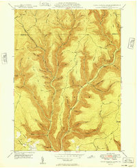
1949 Map of Young Womans Creek
USGS Topo · Published 1949About this map
Stewardson and Chapman townships define the remote forested character of north-central Pennsylvania in this mid-century topographic record. The landscape is dominated by the deep drainage of Young Womans Creek, where numerous hollows and runs like Shingle Mill Hollow and Wildcat Run carve through the high plateaus of Shephard Ridge and Greenlick Ridge. The presence of an Underground Pipe Line cutting across the southern slopes near Summerson Mtn points to the region's role as a transit corridor for energy infrastructure.
Find a feature on this map
64 named features on this map. Tap any name to fly to it.
Don’t see what you’re looking for? This feature index may not catch every label — zoom into the map to look around manually.
Map Details
Editions of this 1949 Young Womans Creek Map
This is the sole edition of this map. No revisions or reprints were ever made.
Other maps of this area

1943 · Hyner
USGS Topo · 1:62,500

1946 · Young Womans Creek
USGS Topo · 1:24,000

1946 · Renovo East
USGS Topo · 1:62,500

1946 · Renovo West
USGS Topo · 1:62,500

1946 · Tamarack
USGS Topo · 1:24,000

1946 · Slate Run
USGS Topo · 1:24,000

1946 · Renovo East
USGS Topo · 1:24,000

1946 · Renovo West
USGS Topo · 1:24,000

1946 · Glen Union
USGS Topo · 1:24,000

1947 · Conrad
USGS Topo · 1:62,500