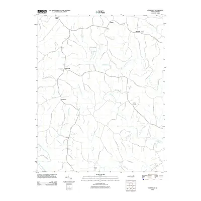
2010 Map of Ayersville
USGS Topo · Published 2010About this map
The Dan River flows through the southwestern corner of this Rockingham County landscape, anchoring a rural region defined by dispersed settlements and family-named landmarks. Small communities such as Ayersville, Prestonville, and Dodgetown are connected by a network of winding local roads, many of which carry the names of long-standing local families like Hub Mabe Rd and Orrell Amos Rd. The area's genealogical significance is highlighted by several established burial grounds, including Buffalo Cemetery, Mount Herman Cemetery, and Bethesda Cemetery, which are positioned near the various forks and branches of the local drainage system.
Find a feature on this map
76 named features on this map. Tap any name to fly to it.
Don’t see what you’re looking for? This feature index may not catch every label — zoom into the map to look around manually.
Map Details
Editions of this 2010 Ayersville Map
This is the sole edition of this map. No revisions or reprints were ever made.
Other maps of this area

1924 · Martinsville
USGS Topo · 1:48,000

1926 · Martinsville
USGS Topo · 1:62,500

1926 · Critz
USGS Topo · 1:48,000

1927 · Martinsville
USGS Topo · 1:62,500

1928 · Critz
USGS Topo · 1:62,500

1944 · Martinsville
USGS Topo · 1:62,500

1953 · Winston-Salem
USGS Topo · 1:250,000

1953 · Greensboro
USGS Topo · 1:250,000

1954 · Greensboro
USGS Topo · 1:250,000

1955 · Winston-Salem
USGS Topo · 1:250,000