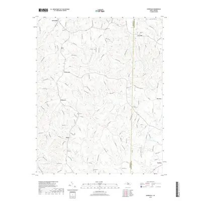
2019 Map of Ayersville
USGS Topo · Published 2019About this map
Dan River bottomlands and the dissected hills of the North Carolina piedmont define this landscape on the border of Stokes and Rockingham counties. The area is characterized by a network of small agricultural settlements and crossroads including Ayersville, Prestonville, and Dodgetown, connected by a dense web of secondary roads like Steele Rd and Doug Stanley Rd. The terrain is heavily etched by the tributaries of the Little Beaver Island and Big Beaver Island creeks, which flow south toward the main river channel near Madison. Genealogists will find several well-documented burial sites across the map, such as Ayersville Cem, Mount Herman Cem, and Bethesda Cem, providing anchors for local family histories in this rural landscape.
Find a feature on this map
121 named features on this map. Tap any name to fly to it.
Don’t see what you’re looking for? This feature index may not catch every label — zoom into the map to look around manually.
Map Details
Editions of this 2019 Ayersville Map
This is the sole edition of this map. No revisions or reprints were ever made.
Other maps of this area

1924 · Martinsville
USGS Topo · 1:48,000

1926 · Martinsville
USGS Topo · 1:62,500

1926 · Critz
USGS Topo · 1:48,000

1927 · Martinsville
USGS Topo · 1:62,500

1928 · Critz
USGS Topo · 1:62,500

1944 · Martinsville
USGS Topo · 1:62,500

1953 · Winston-Salem
USGS Topo · 1:250,000

1953 · Greensboro
USGS Topo · 1:250,000

1954 · Greensboro
USGS Topo · 1:250,000

1955 · Winston-Salem
USGS Topo · 1:250,000