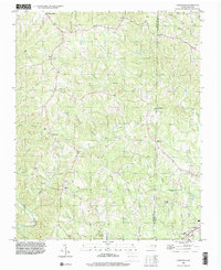
1996 Map of Ayersville
USGS Topo · Published 2001About this map
The rolling landscape along the Stokes Co and Rockingham Co line is defined by a dense network of tributaries flowing toward the Dan River. This 1996 survey illustrates a rural Piedmont community structured around small crossroads settlements and country churches, including Sandy Ridge, Ayersville, and Prestonville. The terrain is deeply incised by waterways such as Big Beaver Island Creek and Buffalo Creek, which likely influenced the historical placement of early homesteads and mills. Genealogists will find a high density of rural religious centers, from Victor Hill Ch in the north to Byrd Memorial Ch near the town of Madison. The presence of numerous unmarked cemeteries and small settlements like Dodgetown and Dillard suggests a landscape of long-established family landholdings and localized social hubs that persisted into the late twentieth century.
Find a feature on this map
29 named features on this map. Tap any name to fly to it.
Don’t see what you’re looking for? This feature index may not catch every label — zoom into the map to look around manually.
Map Details
Editions of this 1996 Ayersville Map
This is the sole edition of this map. No revisions or reprints were ever made.
Other maps of this area

1924 · Martinsville
USGS Topo · 1:48,000

1926 · Martinsville
USGS Topo · 1:62,500

1926 · Critz
USGS Topo · 1:48,000

1927 · Martinsville
USGS Topo · 1:62,500

1928 · Critz
USGS Topo · 1:62,500

1944 · Martinsville
USGS Topo · 1:62,500

1953 · Winston-Salem
USGS Topo · 1:250,000

1953 · Greensboro
USGS Topo · 1:250,000

1954 · Greensboro
USGS Topo · 1:250,000

1955 · Winston-Salem
USGS Topo · 1:250,000