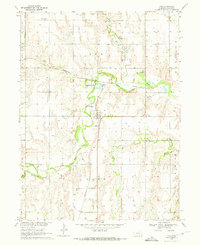
1969 Map of Ayr
USGS Topo · Published 1972About this map
The Little Blue River carves a winding path through this portion of Adams County, anchoring a landscape defined by Nebraska's agricultural and transportation history. In the central part of the quadrangle, the village of Ayr serves as a hub where the Burlington Northern railroad intersects with local life. Nearby, the Crystal Lake State Recreation Area and Camp Snyder offer a glimpse into the region's mid-century recreational development along the water.
Find a feature on this map
22 named features on this map. Tap any name to fly to it.
Don’t see what you’re looking for? This feature index may not catch every label — zoom into the map to look around manually.
Map Details
Editions of this 1969 Ayr Map
This is the sole edition of this map. No revisions or reprints were ever made.
Other maps of this area

1894 · Kenesaw
USGS Topo · 1:62,500

1896 · Wood River
USGS Topo · 1:125,000

1897 · Red Cloud
USGS Topo · 1:125,000

1898 · Superior
USGS Topo · 1:125,000

1898 · Grand Island
USGS Topo · 1:125,000

1955 · Grand Island
USGS Topo · 1:250,000

1957 · Grand Island
USGS Topo · 1:250,000

1958 · Grand Island
USGS Topo · 1:250,000

1969 · Hastings East
USGS Topo · 1:24,000

1969 · Lawrence
USGS Topo · 1:24,000