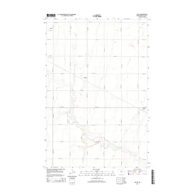
2014 Map of Ayr SE
USGS Topo · Published 2014About this map
The Rush River carves a winding path through the agricultural landscape of western Cass County, defining the drainage and topography of this North Dakota prairie. In the northwestern corner of the quadrangle, the community of Erie sits at the junction of 148th Ave SE and 20 1/2 St SE, serving as a primary point of settlement. Further south, the map identifies the small locality of Mason and the nearby Peterson Airstrip, illustrating the mix of rural homesteads and local infrastructure. Genealogists and local historians can locate Saint Martins Cem along the southern banks of the river near 27th St SE, a vital landmark for tracing early residents of the region. The grid of section-line roads, including 150th Ave SE and 24th St SE, provides a framework for the vast farmland that dominates the area.
Find a feature on this map
21 named features on this map. Tap any name to fly to it.
Don’t see what you’re looking for? This feature index may not catch every label — zoom into the map to look around manually.
Map Details
Editions of this 2014 Ayr SE Map
This is the sole edition of this map. No revisions or reprints were ever made.
Other maps of this area

1895 · Casselton
USGS Topo · 1:125,000

1897 · Casselton
USGS Topo · 1:125,000

1952 · Grand Forks
USGS Topo · 1:250,000

1953 · Fargo
USGS Topo · 1:250,000

1956 · Fargo
USGS Topo · 1:250,000

1956 · Grand Forks
USGS Topo · 1:250,000

1961 · Casselton
USGS Topo · 1:24,000

1966 · Grand Forks
USGS Topo · 1:250,000

1967 · Ayr NE
USGS Topo · 1:24,000

1967 · Ayr NW
USGS Topo · 1:24,000