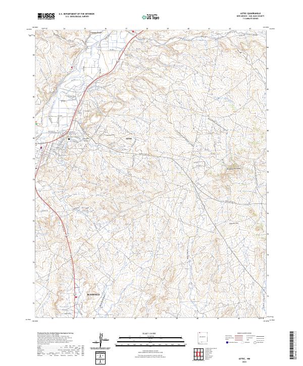
2023 Map of Aztec
USGS Topo · Published 2023About this map
The Animas River valley serves as the central artery for this San Juan County landscape, supporting the communities of Aztec and Bloomfield through an intricate system of irrigation including the Farmers Ditch and Aztec Ditch. This 2023 survey illustrates the intersection of ancient history and modern infrastructure, anchored by the Aztec Ruins National Monument in the northwest. Beyond the river corridor, the terrain breaks into a complex network of dry washes and canyons, such as Knowlton Canyon and Calloway Canyon, which dominate the high desert reaches. Genealogists and local historians will find value in the detailed street grids of the growing settlements and the location of the Aztec Cem. To the east, the topography becomes more pronounced with features like Knickerbocker Peaks and the geological curiosity of Outcrop Arch, marking a sharp transition from the fertile valley floor to the high mesas.
Find a feature on this map
84 named features on this map. Tap any name to fly to it.
Don’t see what you’re looking for? This feature index may not catch every label — zoom into the map to look around manually.
Map Details
Editions of this 2023 Aztec Map
This is the sole edition of this map. No revisions or reprints were ever made.
Other maps of this area

1889 · Largo
USGS Topo · 1:250,000

1889 · Chaco
USGS Topo · 1:250,000

1892 · Chaco
USGS Topo · 1:250,000

1895 · Largo
USGS Topo · 1:250,000

1954 · Shiprock
USGS Topo · 1:250,000

1954 · Aztec
USGS Topo · 1:250,000

1958 · Shiprock
USGS Topo · 1:250,000

1958 · Aztec
USGS Topo · 1:250,000

1959 · Shiprock
USGS Topo · 1:250,000

1959 · Aztec
USGS Topo · 1:62,500