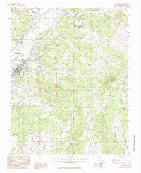
1985 Map of Aztec
USGS Topo · Published 1985About this map
Aztec Ruins National Monument stands as a focal point in the northwest corner of this mid-1980s survey, representing a significant ancestral Puebloan site adjacent to the Animas River. The city of Aztec is densely detailed, showing the layout of the town near the river's eastern banks. The surrounding landscape is characterized by a high concentration of energy infrastructure, with numerous Gas Field notations scattered across the dissected plateaus and mesas.
Find a feature on this map
28 named features on this map. Tap any name to fly to it.
Don’t see what you’re looking for? This feature index may not catch every label — zoom into the map to look around manually.
Map Details
Editions of this 1985 Aztec Map
This is the sole edition of this map. No revisions or reprints were ever made.
Other maps of this area

1889 · Largo
USGS Topo · 1:250,000

1889 · Chaco
USGS Topo · 1:250,000

1892 · Chaco
USGS Topo · 1:250,000

1895 · Largo
USGS Topo · 1:250,000

1954 · Shiprock
USGS Topo · 1:250,000

1954 · Aztec
USGS Topo · 1:250,000

1958 · Shiprock
USGS Topo · 1:250,000

1958 · Aztec
USGS Topo · 1:250,000

1959 · Shiprock
USGS Topo · 1:250,000

1959 · Aztec
USGS Topo · 1:62,500