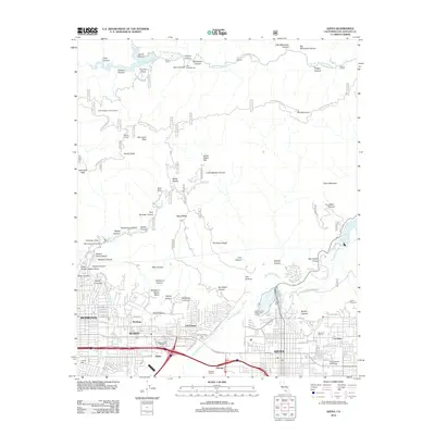
2012 Map of Azusa
USGS Topo · Published 2012About this map
Azusa and Duarte anchor the southern edge of this San Gabriel Valley survey, where urban development meets the steep rise of the Angeles National Forest. This 2012 map captures the intricate boundary between residential communities and the mountain wilderness, featuring institutional landmarks like Azusa Pacific University and Westminster Gardens. The landscape is defined by the San Gabriel River corridor and its tributaries, including Sawpit Wash and Little Dalton Wash, which descend from deep canyons such as Fish Canyon and Roberts Canyon.
Find a feature on this map
105 named features on this map. Tap any name to fly to it.
Don’t see what you’re looking for? This feature index may not catch every label — zoom into the map to look around manually.
Map Details
Editions of this 2012 Azusa Map
This is the sole edition of this map. No revisions or reprints were ever made.
Other maps of this area

1894 · Los Angeles
USGS Topo · 1:62,500

1894 · Pomona
USGS Topo · 1:62,500

1896 · Pasadena
USGS Topo · 1:62,500

1897 · Pomona
USGS Topo · 1:62,500

1898 · Pomona
USGS Topo · 1:62,500

1900 · Pasadena
USGS Topo · 1:62,500

1900 · Tujunga
USGS Topo · 1:62,500

1900 · Los Angeles
USGS Topo · 1:62,500

1901 · Southern California Sheet No. 1
USGS Topo · 1:250,000

1903 · Rock Creek
USGS Topo · 1:62,500