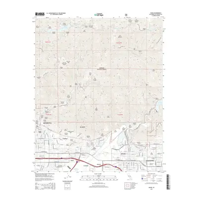
2015 Map of Azusa
USGS Topo · Published 2015About this map
Angeles National Forest occupies the northern half of this landscape, where the San Gabriel Mountains rise sharply above the San Gabriel Valley. This transition from steep wilderness to dense suburban development is marked by extensive flood management infrastructure, including the Santa Fe Flood Control Basin and Bradbury Debris Basin. The San Gabriel River serves as a central artery, fed by a complex network of canyons such as Devils Canyon and Fish Canyon. Within the urban corridor, the map details the established neighborhoods of Monrovia, Duarte, and Azusa, along with the gated community of Bradbury. Educational and medical institutions define the local economy, including Citrus College, Azusa Pacific University, and the City of Hope Graduate School of Biological Sciences. The southern edge reveals a concentration of transport and industry near Irwindale and the Liveoak Cemetery grounds.
Find a feature on this map
178 named features on this map. Tap any name to fly to it.
Don’t see what you’re looking for? This feature index may not catch every label — zoom into the map to look around manually.
Map Details
Editions of this 2015 Azusa Map
This is the sole edition of this map. No revisions or reprints were ever made.
Other maps of this area

1894 · Los Angeles
USGS Topo · 1:62,500

1894 · Pomona
USGS Topo · 1:62,500

1896 · Pasadena
USGS Topo · 1:62,500

1897 · Pomona
USGS Topo · 1:62,500

1898 · Pomona
USGS Topo · 1:62,500

1900 · Pasadena
USGS Topo · 1:62,500

1900 · Tujunga
USGS Topo · 1:62,500

1900 · Los Angeles
USGS Topo · 1:62,500

1901 · Southern California Sheet No. 1
USGS Topo · 1:250,000

1903 · Rock Creek
USGS Topo · 1:62,500