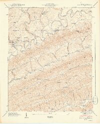
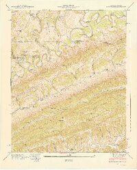
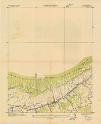
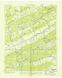
1948 Map of Back Valley
USGS Topo · Published 1949About this map
The Powell River snakes through the center of this 1948 survey, carving a deep path between the steep ridges of Wallen Ridge and Chestnut Ridge. This rural borderland between Tennessee and Virginia is defined by a dense network of mountain hollows and gaps, such as Bales Gap and Gibson Gap, which dictated the location of early roads and settlements. Local commerce is centered around small operations like Thompson Mill on Fourmile Creek and Mathis Mill near the southern edge of the map.
Find a feature on this map
83 named features on this map. Tap any name to fly to it.
Don’t see what you’re looking for? This feature index may not catch every label — zoom into the map to look around manually.
Map Details
Editions of this 1948 Back Valley Map
2 editions found
Other maps of this area

1883 · Morristown
USGS Topo · 1:125,000

1887 · Jonesville
USGS Topo · 1:125,000

1891 · Jonesville
USGS Topo · 1:125,000

1893 · Morristown
USGS Topo · 1:125,000

1895 · Morristown
USGS Topo · 1:125,000

1932 · Hagan
USGS Topo · 1:62,500
1935 · Ewing
USGS Topo · 1:24,000

1935 · Rogersville
USGS Topo · 1:48,000

1935 · Tate Springs
USGS Topo · 1:48,000
1935 · Lee Valley
USGS Topo · 1:24,000