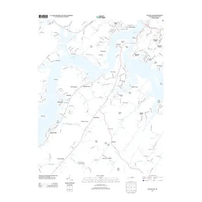
2013 Map of Bacon Gap
USGS Topo · Published 2013About this map
Watts Bar Lake and its intricate fingers dominate this Roane County landscape, shaping a series of residential developments and recreational hubs. The shoreline is marked by distinctive points and bars such as South West Point, Turner Bar, and Shields Bar, while the interior is defined by the sharp relief of the River Knobs and Pisgah Ridge. This 2013 survey illustrates the dense concentration of modern lakeside communities including Lakeview, Sequoyah Shores, and Cherokee Hills, juxtaposed with the older, grounded place names of the rural interior.
Find a feature on this map
72 named features on this map. Tap any name to fly to it.
Don’t see what you’re looking for? This feature index may not catch every label — zoom into the map to look around manually.
Map Details
Editions of this 2013 Bacon Gap Map
This is the sole edition of this map. No revisions or reprints were ever made.
Other maps of this area

1887 · Kingston
USGS Topo · 1:125,000

1891 · Kingston
USGS Topo · 1:125,000

1893 · Kingston
USGS Topo · 1:125,000

1895 · Loudon
USGS Topo · 1:125,000

1935 · Rockwood
USGS Topo · 1:24,000

1935 · Elverton
USGS Topo · 1:24,000

1935 · Harriman
USGS Topo · 1:24,000

1935 · Philadelphia
USGS Topo · 1:24,000

1936 · Cave Creek
USGS Topo · 1:24,000

1936 · Cardiff
USGS Topo · 1:24,000