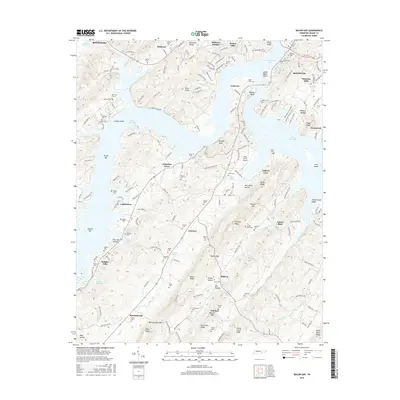
2016 Map of Bacon Gap
USGS Topo · Published 2016About this map
Kingston sits at a strategic bend in the Tennessee River system, where the sprawling waters of Watts Bar Lake meet the mouth of the Clinch River. This 2016 survey captures the area’s complex topography, from the sharp ridges of the River Knobs to the deep incisions of Bacon Gap and Suck-egg Hollow. The landscape is densely populated with historical markers, particularly small family and community burial grounds like Shields Cem, Bethel Cem, and the notable Slave Cem near Wester Bluff.
Find a feature on this map
188 named features on this map. Tap any name to fly to it.
Don’t see what you’re looking for? This feature index may not catch every label — zoom into the map to look around manually.
Map Details
Editions of this 2016 Bacon Gap Map
This is the sole edition of this map. No revisions or reprints were ever made.
Other maps of this area

1887 · Kingston
USGS Topo · 1:125,000

1891 · Kingston
USGS Topo · 1:125,000

1893 · Kingston
USGS Topo · 1:125,000

1895 · Loudon
USGS Topo · 1:125,000

1935 · Rockwood
USGS Topo · 1:24,000

1935 · Elverton
USGS Topo · 1:24,000

1935 · Harriman
USGS Topo · 1:24,000

1935 · Philadelphia
USGS Topo · 1:24,000

1936 · Cave Creek
USGS Topo · 1:24,000

1936 · Cardiff
USGS Topo · 1:24,000