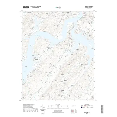
2019 Map of Bacon Gap
USGS Topo · Published 2019About this map
Kingston anchors the eastern edge of this landscape where the Tennessee River meets the expansive waters of Watts Bar Lake. The terrain is defined by a series of parallel ridges and gaps, most notably Bacon Gap and Ponders Gap, which have historically dictated the placement of roads and settlements. This 2019 survey documents a dense network of family and community history, evidenced by numerous small burial sites such as Bacon Cem, Bethel Cem, and Shiloh Cem.
Find a feature on this map
101 named features on this map. Tap any name to fly to it.
Don’t see what you’re looking for? This feature index may not catch every label — zoom into the map to look around manually.
Map Details
Editions of this 2019 Bacon Gap Map
This is the sole edition of this map. No revisions or reprints were ever made.
Other maps of this area

1887 · Kingston
USGS Topo · 1:125,000

1891 · Kingston
USGS Topo · 1:125,000

1893 · Kingston
USGS Topo · 1:125,000

1895 · Loudon
USGS Topo · 1:125,000

1935 · Rockwood
USGS Topo · 1:24,000

1935 · Elverton
USGS Topo · 1:24,000

1935 · Harriman
USGS Topo · 1:24,000

1935 · Philadelphia
USGS Topo · 1:24,000

1936 · Cave Creek
USGS Topo · 1:24,000

1936 · Cardiff
USGS Topo · 1:24,000