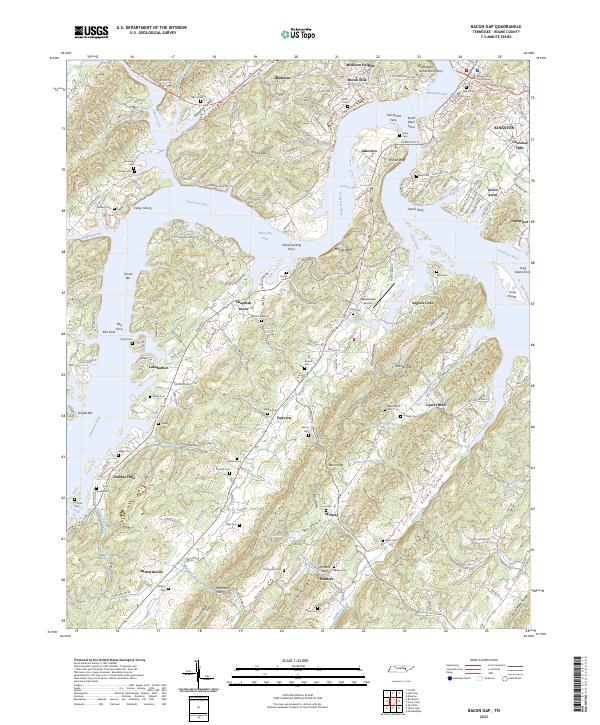
2023 Map of Bacon Gap
USGS Topo · Published 2023About this map
The Roane County Courthouse stands as a focal point near Kingston, where the Tennessee River and Watts Bar Lake dominate the geography. This landscape is defined by the sharp transition between the deep river waters and the prominent ridges like Pisgah Ridge and Bacon Ridge. The map documents a complex network of historical crossings and landmarks, including James Ferry and Hood Landing Ferry, which hint at the region's long-standing reliance on water transport. For genealogists and local historians, the high density of family-named burial sites such as Bethel Cem, Shiloh Cem, and the notable Slave Cem provides a detailed record of the communities that settled between the River Knobs and Stamp Creek Valley. From the established streets of Midtown to the aviation hub at Meadowlake Airport, the map captures the evolution of Roane County's infrastructure.
Find a feature on this map
224 named features on this map. Tap any name to fly to it.
Don’t see what you’re looking for? This feature index may not catch every label — zoom into the map to look around manually.
Map Details
Editions of this 2023 Bacon Gap Map
This is the sole edition of this map. No revisions or reprints were ever made.
Other maps of this area

1887 · Kingston
USGS Topo · 1:125,000

1891 · Kingston
USGS Topo · 1:125,000

1893 · Kingston
USGS Topo · 1:125,000

1895 · Loudon
USGS Topo · 1:125,000

1935 · Rockwood
USGS Topo · 1:24,000

1935 · Elverton
USGS Topo · 1:24,000

1935 · Harriman
USGS Topo · 1:24,000

1935 · Philadelphia
USGS Topo · 1:24,000

1936 · Cave Creek
USGS Topo · 1:24,000

1936 · Cardiff
USGS Topo · 1:24,000