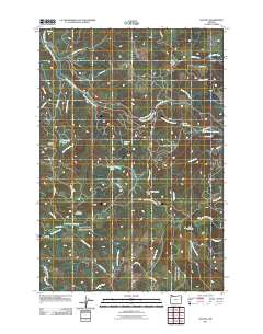
2011 Map of Bacona
USGS Topo · Published 2011About this map
Bacona stands as the primary settlement on this landscape, which is defined by the high ridges and watercourses of northwestern Oregon. The territory is heavily shaped by forest management and fire prevention, as evidenced by Mansfield Lookout and Pisgah Lookout perched atop the high ground. The drainage pattern is complex, with the East Fork Nehalem River cutting through the northern section and the South Scappoose Creek and East Fork Dairy Creek flowing south, indicating the area's role as a hydrological divide.
Find a feature on this map
49 named features on this map. Tap any name to fly to it.
Don’t see what you’re looking for? This feature index may not catch every label — zoom into the map to look around manually.
Map Details
Editions of this 2011 Bacona Map
This is the sole edition of this map. No revisions or reprints were ever made.
Other maps of this area

1915 · Hillsboro
USGS Topo · 1:62,500

1918 · Hillsboro
USGS Topo · 1:62,500

1922 · St. Helens
USGS Topo · 1:62,500

1940 · Hillsboro
USGS Topo · 1:62,500

1940 · Vernonia
USGS Topo · 1:62,500

1941 · St Helens
USGS Topo · 1:62,500

1941 · Gales Creek
USGS Topo · 1:62,500

1943 · Vernonia
USGS Topo · 1:62,500

1943 · St Helens
USGS Topo · 1:62,500

1948 · Vancouver
USGS Topo · 1:250,000