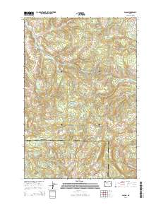
2014 Map of Bacona
USGS Topo · Published 2014About this map
Bacona sits at the southwestern edge of this landscape, positioned along NW Bacona Rd near the border of Columbia and Washington counties. The area is defined by a high-elevation drainage divide where the headwaters of the E Fork Nehalem River flow northward while the E Fork Dairy Creek and Panther Cr drain to the south. This transition point is marked by notable peaks such as Bunker Hill, Tater Hill, and Long Mountain. A network of forest roads, including the Scappoose Vernonia Hwy and Crown Zellerbach Rd, weaves through the timberlands, connecting small water features like Gunners Lakes, Mansfield Pond, and the Heller Reservoir. In the eastern section, Dutch Canyon drops away from the ridgelines toward the valley floor, illustrating the complex geography of the Northern Oregon Coast Range foothills.
Find a feature on this map
49 named features on this map. Tap any name to fly to it.
Don’t see what you’re looking for? This feature index may not catch every label — zoom into the map to look around manually.
Map Details
Editions of this 2014 Bacona Map
This is the sole edition of this map. No revisions or reprints were ever made.
Other maps of this area

1915 · Hillsboro
USGS Topo · 1:62,500

1918 · Hillsboro
USGS Topo · 1:62,500

1922 · St. Helens
USGS Topo · 1:62,500

1940 · Hillsboro
USGS Topo · 1:62,500

1940 · Vernonia
USGS Topo · 1:62,500

1941 · St Helens
USGS Topo · 1:62,500

1941 · Gales Creek
USGS Topo · 1:62,500

1943 · Vernonia
USGS Topo · 1:62,500

1943 · St Helens
USGS Topo · 1:62,500

1948 · Vancouver
USGS Topo · 1:250,000