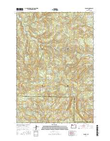
2017 Map of Bacona
USGS Topo · Published 2017About this map
Dutch Canyon and the high ridges of the Northern Oregon Coast Range define this landscape along the boundary of Washington and Columbia counties. The terrain is marked by a complex network of forestry and access roads, including the Crown Zellerbach Trail and various mainline routes like the Gunners Lake Mainline. These paths trace the elevations between Bunker Hill and Long Mtn, reflecting the area's history of industrial timber management and resource extraction. Significant water features such as the E Fork Nehalem River and Clatskanie River originate in these highlands, while smaller points of interest like Gunners Lakes and Mansfield Pond are scattered throughout the drainage basins. Evidence of 20th-century public works remains visible through the alignment of the Bacona CCC Rd, a local link to the Civilian Conservation Corps era.
Find a feature on this map
59 named features on this map. Tap any name to fly to it.
Don’t see what you’re looking for? This feature index may not catch every label — zoom into the map to look around manually.
Map Details
Editions of this 2017 Bacona Map
This is the sole edition of this map. No revisions or reprints were ever made.
Other maps of this area

1915 · Hillsboro
USGS Topo · 1:62,500

1918 · Hillsboro
USGS Topo · 1:62,500

1922 · St. Helens
USGS Topo · 1:62,500

1940 · Hillsboro
USGS Topo · 1:62,500

1940 · Vernonia
USGS Topo · 1:62,500

1941 · St Helens
USGS Topo · 1:62,500

1941 · Gales Creek
USGS Topo · 1:62,500

1943 · Vernonia
USGS Topo · 1:62,500

1943 · St Helens
USGS Topo · 1:62,500

1948 · Vancouver
USGS Topo · 1:250,000