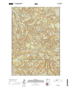
2020 Map of Bacona
USGS Topo · Published 2020About this map
Dutch Canyon and the surrounding timberlands of the Northern Oregon Coast Range define this landscape along the border of Columbia and Washington counties. This modern survey illustrates a region shaped by a deep history of forestry and transportation, centered around the Crown Zellerbach Trail and the Scappoose Vernonia Hwy. The complex network of service roads, including the Gunners Lakes Mnln and Pisgah Home Rd, speaks to the long-standing industrial management of the watershed.
Find a feature on this map
94 named features on this map. Tap any name to fly to it.
Don’t see what you’re looking for? This feature index may not catch every label — zoom into the map to look around manually.
Map Details
Editions of this 2020 Bacona Map
This is the sole edition of this map. No revisions or reprints were ever made.
Other maps of this area

1915 · Hillsboro
USGS Topo · 1:62,500

1918 · Hillsboro
USGS Topo · 1:62,500

1922 · St. Helens
USGS Topo · 1:62,500

1940 · Hillsboro
USGS Topo · 1:62,500

1940 · Vernonia
USGS Topo · 1:62,500

1941 · St Helens
USGS Topo · 1:62,500

1941 · Gales Creek
USGS Topo · 1:62,500

1943 · Vernonia
USGS Topo · 1:62,500

1943 · St Helens
USGS Topo · 1:62,500

1948 · Vancouver
USGS Topo · 1:250,000