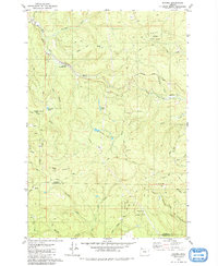
1979 Map of Bacona
USGS Topo · Published 1980About this map
Clatsop State Forest and Tillamook State Forest dominate the timbered uplands of the Northern Oregon Coast Range in this late-1970s topographical survey. The small settlement of Bacona sits near the border of Columbia and Washington counties, serving as a landmark for the network of forestry and private roads including Bacona Road and Corral Road that snake through the drainage basins. Water management and natural resources are evident in the numerous quarries and pits, such as Hawkins Pit and the Borrow Pit, alongside man-made water bodies like Mansfield Pond and Floeter Pond. The Nehalem River winds across the northern section near the Scaponia Recreation Site, while higher elevations are marked by the Mansfield Lookout and Radio Towers atop Long Mountain, highlighting the area's importance for both forest fire monitoring and communication infrastructure during this era.
Find a feature on this map
47 named features on this map. Tap any name to fly to it.
Don’t see what you’re looking for? This feature index may not catch every label — zoom into the map to look around manually.
Map Details
Editions of this 1979 Bacona Map
This is the sole edition of this map. No revisions or reprints were ever made.
Other maps of this area

1915 · Hillsboro
USGS Topo · 1:62,500

1918 · Hillsboro
USGS Topo · 1:62,500

1922 · St. Helens
USGS Topo · 1:62,500

1940 · Hillsboro
USGS Topo · 1:62,500

1940 · Vernonia
USGS Topo · 1:62,500

1941 · St Helens
USGS Topo · 1:62,500

1941 · Gales Creek
USGS Topo · 1:62,500

1943 · Vernonia
USGS Topo · 1:62,500

1943 · St Helens
USGS Topo · 1:62,500

1948 · Vancouver
USGS Topo · 1:250,000