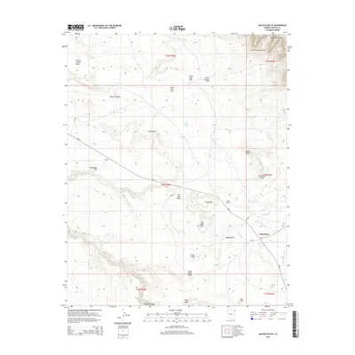
2014 Map of Bad Bug Butte
USGS Topo · Published 2014About this map
The Lukachukai Mountains and the Chuska Mountains dominate the northeastern corner of this Navajo Nation landscape, providing a high-elevation backdrop to the high desert plateaus below. The settlement of Lukachukai serves as a primary hub in the southeast, situated where Greasewood Wash and Tohotso Cr descend from the mountains. This 2014 survey documents a complex network of Bureau of Indian Affairs routes, such as Bia-12 and Bia-13, which connect smaller settlements like Toohidazdii and Tsedadahot Sosi across the mesa-dissected terrain.
Find a feature on this map
37 named features on this map. Tap any name to fly to it.
Don’t see what you’re looking for? This feature index may not catch every label — zoom into the map to look around manually.
Map Details
Editions of this 2014 Bad Bug Butte Map
This is the sole edition of this map. No revisions or reprints were ever made.
Other maps of this area

1892 · Canyon De Chelly
USGS Topo · 1:250,000

1953 · Redrock Valley SW
USGS Topo · 1:24,000

1953 · Los Gigantes SE
USGS Topo · 1:24,000

1953 · Los Gigantes SW
USGS Topo · 1:24,000

1953 · Los Gigantes Buttes
USGS Topo · 1:62,500

1953 · Redrock Valley
USGS Topo · 1:62,500

1954 · Shiprock
USGS Topo · 1:250,000
1955 · Sonsala Butte 1 NW
USGS Topo · 1:24,000

1955 · Sonsala Butte 2 SW
USGS Topo · 1:24,000

1955 · Sonsala Butte 2 NW
USGS Topo · 1:24,000