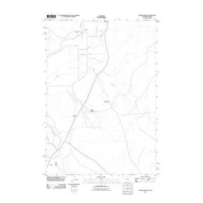
2011 Map of Badger Basin
USGS Topo · Published 2011About this map
Badger Basin defines this high-desert corridor in Park County, where the Clarks Fork Yellowstone River winds through a landscape marked by legacy ranching and early 21st-century water management. The mapping reveals a complex network of irrigation infrastructure essential to the region's agricultural viability, including the State Ditch, Sirrine Ditch, and Interstate Ditch. These human-made waterways diverge from natural drainages like Big Sand Coulee to support established holdings such as the Walker Ranch and Chesarek Ranch.
Find a feature on this map
25 named features on this map. Tap any name to fly to it.
Don’t see what you’re looking for? This feature index may not catch every label — zoom into the map to look around manually.
Map Details
Editions of this 2011 Badger Basin Map
This is the sole edition of this map. No revisions or reprints were ever made.
Other maps of this area

1944 · Red Lodge
USGS Topo · 1:62,500

1950 · Clark
USGS Topo · 1:62,500

1954 · Billings
USGS Topo · 1:250,000

1955 · Cody
USGS Topo · 1:250,000

1957 · Billings
USGS Topo · 1:250,000

1958 · Billings
USGS Topo · 1:250,000

1958 · Cody
USGS Topo · 1:250,000

1962 · Cody
USGS Topo · 1:250,000

1966 · Elk Basin SW
USGS Topo · 1:24,000

1966 · Elk Basin NW
USGS Topo · 1:24,000