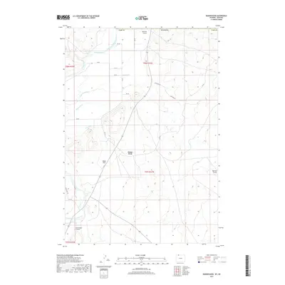
2017 Map of Badger Basin
USGS Topo · Published 2017About this map
The Clarks Fork Yellowstone River carves through the northwestern corner of this Park County landscape, defining a region where water management is central to the land's utility. A complex network of irrigation channels, including Interstate Ditch, Doctor Ditch, and Simpson Ditch, spiderwebs across the terrain to support agricultural efforts near Badger Basin. These man-made waterways contrast with the natural carved landforms of Big Sand Coulee and Little Sand Coulee that drain the eastern and southern portions of the quadrangle. Transport routes like the Overland Trl and Derby Ranch Rd suggest a history of movement and ranching in this high-plains environment. The map details a sophisticated system of water rights and distribution, with the State Ditch and Sirrine Ditch marking the intersection of public infrastructure and private land use in the Wyoming basin.
Find a feature on this map
28 named features on this map. Tap any name to fly to it.
Don’t see what you’re looking for? This feature index may not catch every label — zoom into the map to look around manually.
Map Details
Editions of this 2017 Badger Basin Map
This is the sole edition of this map. No revisions or reprints were ever made.
Other maps of this area

1944 · Red Lodge
USGS Topo · 1:62,500

1950 · Clark
USGS Topo · 1:62,500

1954 · Billings
USGS Topo · 1:250,000

1955 · Cody
USGS Topo · 1:250,000

1957 · Billings
USGS Topo · 1:250,000

1958 · Billings
USGS Topo · 1:250,000

1958 · Cody
USGS Topo · 1:250,000

1962 · Cody
USGS Topo · 1:250,000

1966 · Elk Basin SW
USGS Topo · 1:24,000

1966 · Elk Basin NW
USGS Topo · 1:24,000