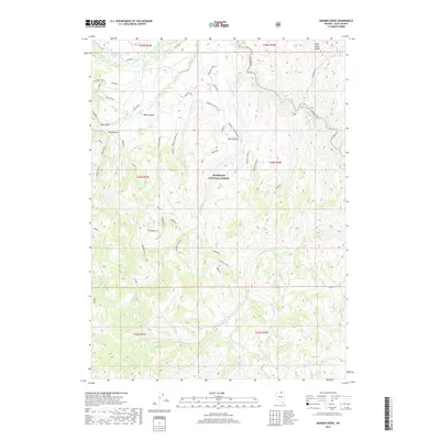
2018 Map of Badger Creek
USGS Topo · Published 2018About this map
The Humboldt National Forest dominates this section of Elko County, where the high-altitude terrain is carved by a complex network of canyons and drainage systems. The landscape transitions between the Wild Horse Range to the northeast and the Haystack Range in the northwest, with the Owyhee River cutting through the northern reaches. This 2018 survey reveals a heavy reliance on a network of named forest service roads and spurs—such as Hansen Shortcut, Road 7, and various branches of the Badger and George systems—essential for navigating the steep elevation changes between Cow Canyon and the series of numbered gulches. Water is a defining element of the geography, with numerous creeks like Van Duzer Creek and North Fork Deep Creek flowing through the rugged draws, indicating the seasonal water cycles typical of the Nevada backcountry.
Find a feature on this map
61 named features on this map. Tap any name to fly to it.
Don’t see what you’re looking for? This feature index may not catch every label — zoom into the map to look around manually.
Map Details
Editions of this 2018 Badger Creek Map
This is the sole edition of this map. No revisions or reprints were ever made.
Other maps of this area

1936 · Mountain City
USGS Topo · 1:62,500

1939 · Owyhee
USGS Topo · 1:62,500

1940 · Mountain City
USGS Topo · 1:62,500

1942 · Owyhee
USGS Topo · 1:62,500

1955 · McDermitt
USGS Topo · 1:250,000

1955 · Wells
USGS Topo · 1:250,000

1956 · Bull Run
USGS Topo · 1:62,500

1956 · Wild Horse
USGS Topo · 1:62,500

1958 · Wells
USGS Topo · 1:250,000

1959 · McDermitt
USGS Topo · 1:250,000