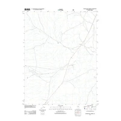
2012 Map of Badger Hole Spring
USGS Topo · Published 2012About this map
The White River winds through this high-desert landscape in White Pine County, forming a primary drainage system alongside tributaries like Ellison Cr and Cottonwood Cr. Human activity in this arid basin centers on scattered ranching operations and vital water sources, as seen at Gardner Ranch and Davis Ranch. These outposts sit near a network of remote service roads, including NFD 402 RD and NFD 405 RD, which provide access to the area's essential hydrology.
Find a feature on this map
13 named features on this map. Tap any name to fly to it.
Don’t see what you’re looking for? This feature index may not catch every label — zoom into the map to look around manually.
Map Details
Editions of this 2012 Badger Hole Spring Map
This is the sole edition of this map. No revisions or reprints were ever made.
Other maps of this area

1949 · Treasure Hill
USGS Topo · 1:62,500

1950 · Treasure Hill
USGS Topo · 1:62,500

1956 · Lund
USGS Topo · 1:250,000

1956 · Ely
USGS Topo · 1:250,000

1957 · Currant Mtn
USGS Topo · 1:62,500

1959 · Ely
USGS Topo · 1:250,000

1959 · Preston Reservoir
USGS Topo · 1:62,500

1960 · Lund
USGS Topo · 1:250,000

1963 · Ely
USGS Topo · 1:250,000

1964 · Currant Mtn
USGS Topo · 1:62,500