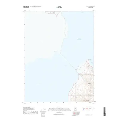
2020 Map of Badger Island
USGS Topo · Published 2020About this map
Great Salt Lake dominates this landscape, showing the shorelines and island formations of Tooele County, Utah. The topographic detail focuses on the northern half of Stansbury Island, where elevations rise from the shoreline to prominent peaks such as Boulder Point. The western flank of the island is defined by the broad Stansbury Bay, while the eastern side features more sheltered inlets like Stansbury Bight and Sandy Beach Bay. To the north and west, the map identifies small outcrops including Badger Island and a portion of Carrington Island. In the rugged interior of the main island, Pass Canyon cuts through the terrain, suggesting a natural route through the higher elevations. This survey provides a precise look at the interface between the lake's shifting waters and the distinctive island topography in the early twenty-first century.
Find a feature on this map
11 named features on this map. Tap any name to fly to it.
Don’t see what you’re looking for? This feature index may not catch every label — zoom into the map to look around manually.
Map Details
Editions of this 2020 Badger Island Map
This is the sole edition of this map. No revisions or reprints were ever made.
Other maps of this area

1885 · Tooele Valley
USGS Topo · 1:250,000

1953 · Tooele
USGS Topo · 1:250,000

1954 · Brigham City
USGS Topo · 1:250,000

1955 · Tooele
USGS Topo · 1:250,000

1958 · Brigham City
USGS Topo · 1:250,000

1962 · Brigham City
USGS Topo · 1:250,000

1968 · Plug Peak NW
USGS Topo · 1:24,000

1968 · Carrington Island SW
USGS Topo · 1:24,000

1968 · Fremont Island SW
USGS Topo · 1:24,000

1968 · Poverty Point
USGS Topo · 1:24,000