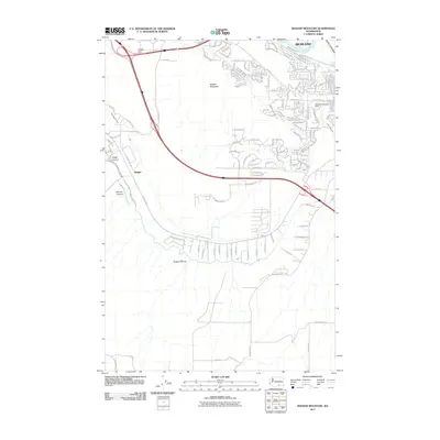
2011 Map of Badger Mountain
USGS Topo · Published 2011About this map
Richland and the smaller settlement of Badger define this transition from urban edges to the high desert of the Benton County interior. The landscape is dominated by the prominent profile of Badger Mountain, where residential growth from the north meets the dramatic physical relief of Goose Gap and Sheep Canyon. Water management is central to the area's development, evidenced by the Columbia Canal and the East Badger Lateral, which snake along the terrain contours to provide irrigation.
Find a feature on this map
144 named features on this map. Tap any name to fly to it.
Don’t see what you’re looking for? This feature index may not catch every label — zoom into the map to look around manually.
Map Details
Editions of this 2011 Badger Mountain Map
This is the sole edition of this map. No revisions or reprints were ever made.
Other maps of this area

1917 · Pasco
USGS Topo · 1:125,000

1951 · Richland
USGS Topo · 1:62,500

1953 · Walla Walla
USGS Topo · 1:250,000

1958 · Walla Walla
USGS Topo · 1:250,000
1964 · Johnson Butte
USGS Topo · 1:24,000

1964 · Kennewick
USGS Topo · 1:24,000

1964 · Pasco
USGS Topo · 1:62,500
1965 · Prior Ranch
USGS Topo · 1:24,000

1965 · Eltopia
USGS Topo · 1:62,500
1965 · Weber Canyon
USGS Topo · 1:24,000