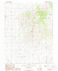
1989 Map of Badger Peak
USGS Topo · Published 1989About this map
Black Mountains dominate this high-desert landscape of Iron County, where steep drainages and prominent summits define the region's character in the late 1980s. A series of sequential canyons—First Canyon, Second Canyon, and Third Canyon—cut through the western slopes, while the high ground is marked by prominent landmarks like Badger Peak, Monument Peak, and Mule Peak. The geography is shaped by the transition from the mountain heights to the expansive Mud Spring Bench in the south and Horse Valley to the east.
Find a feature on this map
20 named features on this map. Tap any name to fly to it.
Don’t see what you’re looking for? This feature index may not catch every label — zoom into the map to look around manually.
Map Details
Editions of this 1989 Badger Peak Map
This is the sole edition of this map. No revisions or reprints were ever made.
Other maps of this area

1885 · St. George
USGS Topo · 1:250,000

1891 · St. George
USGS Topo · 1:250,000

1950 · Enoch
USGS Topo · 1:62,500

1950 · Enoch NE
USGS Topo · 1:24,000

1951 · Avon
USGS Topo · 1:24,000
1952 · Enoch NW
USGS Topo · 1:24,000

1952 · Enoch NE
USGS Topo · 1:24,000

1953 · Ninemile Knoll
USGS Topo · 1:24,000

1953 · Richfield
USGS Topo · 1:250,000

1953 · Cedar City
USGS Topo · 1:250,000