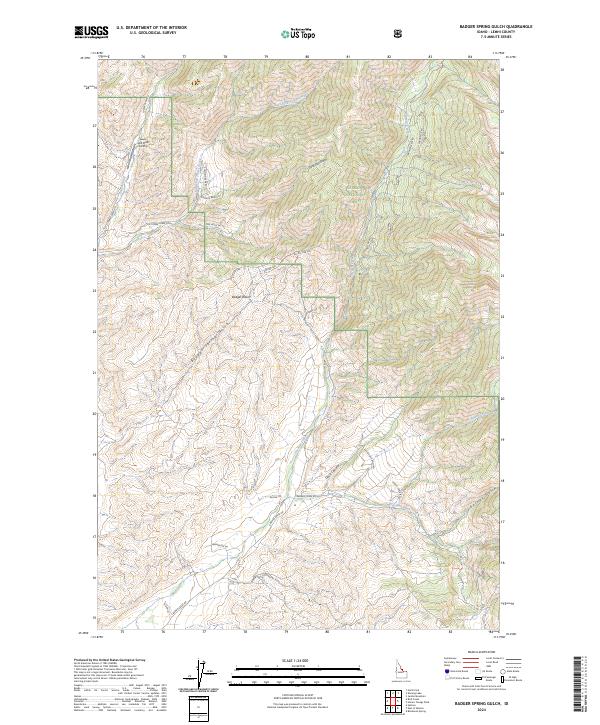
2024 Map of Badger Spring Gulch
USGS Topo · Published 2024About this map
Salmon National Forest dominates this Idaho landscape, where high-elevation basins and steep gulches form a complex network of drainages feeding the local creeks. The presence of the Lewis and Clark Airstrip in the northwest corner, near Tower Creek, highlights the reliance on small-scale aviation in these mountainous reaches of Lemhi County. The terrain is deeply incised by features like Gold Star Gulch and Badger Spring Gulch, which provide natural corridors for historic travel and modern forest access.
Find a feature on this map
35 named features on this map. Tap any name to fly to it.
Don’t see what you’re looking for? This feature index may not catch every label — zoom into the map to look around manually.
Map Details
Editions of this 2024 Badger Spring Gulch Map
This is the sole edition of this map. No revisions or reprints were ever made.
Other maps of this area

1950 · Salmon
USGS Topo · 1:62,500

1951 · Salmon
USGS Topo · 1:62,500

1955 · Dillon
USGS Topo · 1:250,000

1956 · Goldstone Mtn
USGS Topo · 1:62,500

1957 · Dillon
USGS Topo · 1:250,000

1958 · Dillon
USGS Topo · 1:250,000

1962 · Dillon
USGS Topo · 1:250,000

1965 · Dillon
USGS Topo · 1:250,000

1966 · Badger Spring Gulch
USGS Topo · 1:24,000

1966 · Shewag Lake
USGS Topo · 1:24,000