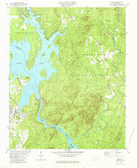
1981 Map of Badin
USGS Topo · Published 1981About this map
Badin Lake and the Yadkin River dominate this 1981 survey of the boundary between Montgomery and Stanly counties. The landscape is defined by the industrial and recreational infrastructure of the early 1980s, featuring a filtration plant and multiple powerplants along the river's course. The terrain transitions from the developed town of Badin to the protected woodlands of the Uwharrie National Forest and Morrow Mountain State Park.
Find a feature on this map
54 named features on this map. Tap any name to fly to it.
Don’t see what you’re looking for? This feature index may not catch every label — zoom into the map to look around manually.
Map Details
Editions of this 1981 Badin Map
2 editions found
Other maps of this area

1942 · Troy
USGS Topo · 1:125,000

1949 · High Rock
USGS Topo · 1:24,000

1953 · Raleigh
USGS Topo · 1:250,000

1953 · Charlotte
USGS Topo · 1:250,000

1954 · Charlotte
USGS Topo · 1:250,000

1954 · Raleigh
USGS Topo · 1:250,000

1957 · Albemarle
USGS Topo · 1:62,500

1957 · Denton
USGS Topo · 1:62,500

1957 · Troy
USGS Topo · 1:62,500

1957 · Asheboro
USGS Topo · 1:62,500