
1982 Map of Badnation SE
USGS Topo · Published 1982About this map
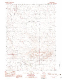
The Rosebud Indian Reservation occupies the southern half of this landscape, where the meandering drainage of Oak Creek carves a deep path through the South Dakota prairie. Based on field checks from 1978 and aerial photography from earlier in the decade, this survey illustrates a transition between the expansive tribal lands and the open country to the north. Waterways like Louis Creek and McChesneys Creek provide the primary geographical structure to the region, which is marked by high points such as the prominent Butte in the southwest corner. Human impact is sparse, indicated primarily by a singular Gravel Pit and a network of unimproved roads and trails. This 1982 provisional edition serves as a clear record of the rural landscape of Mellette County before later development, preserving the exact township and range boundaries of T 42 N and T 41 N.
Find a feature on this map
8 named features on this map. Tap any name to fly to it.
Don’t see what you’re looking for? This feature index may not catch every label — zoom into the map to look around manually.
Map Details
Editions of this 1982 Badnation SE Map
This is the sole edition of this map. No revisions or reprints were ever made.
Other maps of this area

1951 · Badnation
USGS Topo · 1:24,000

1951 · Badnation NW
USGS Topo · 1:24,000

1951 · Presho 4 NW
USGS Topo · 1:24,000

1955 · Martin
USGS Topo · 1:250,000

1958 · Martin
USGS Topo · 1:250,000

1982 · Two Nation Creek
USGS Topo · 1:25,000

1982 · Wood North
USGS Topo · 1:24,000
1982 · Carter
USGS Topo · 1:25,000

1982 · Mosher
USGS Topo · 1:25,000
1982 · Wood South
USGS Topo · 1:24,000