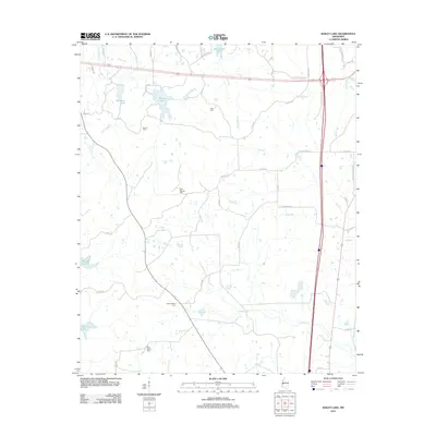
2012 Map of Bailey Lake
USGS Topo · Published 2012About this map
Family-named cemeteries and a complex network of small waterways characterize this 2012 survey of the rural landscape north of Winona. The map is notably dense with burial sites that provide essential clues for genealogists, including Summerfield Cem, Nebo Cem, Bluff Springs Cem, Marvin Cem, and New Salem Cem. These locations are often tucked away near county roads, such as Co RD-70 and Co RD-64, marking the historical centers of community life in Montgomery County.
Find a feature on this map
51 named features on this map. Tap any name to fly to it.
Don’t see what you’re looking for? This feature index may not catch every label — zoom into the map to look around manually.
Map Details
Editions of this 2012 Bailey Lake Map
This is the sole edition of this map. No revisions or reprints were ever made.
Other maps of this area

1953 · West Point
USGS Topo · 1:250,000

1954 · Duck Hill
USGS Topo · 1:62,500

1954 · McCarley
USGS Topo · 1:62,500

1958 · West Point
USGS Topo · 1:250,000

1963 · West Point
USGS Topo · 1:250,000

1966 · Winona
USGS Topo · 1:24,000
1966 · Vaiden
USGS Topo · 1:24,000

1968 · Winona
USGS Topo · 1:62,500
1975 · Peachahala Creek
USGS Topo · 1:24,000
1975 · Murdock Lake
USGS Topo · 1:24,000