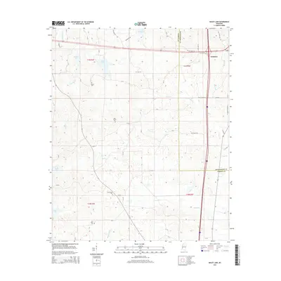
2015 Map of Bailey Lake
USGS Topo · Published 2015About this map
The western outskirts of Winona anchor this topographic study of the borderlands between Montgomery County and Carroll County. The landscape is defined by the headwaters and drainages of several major creeks, including Little Sand Creek and Powells Creek, which cut through the varied elevations of North Central Mississippi. Small upland water bodies like Bailey Lake and Barrentine Lake are scattered across the terrain, alongside numerous smaller basins such as Booths Lake and Waters Lake.
Find a feature on this map
56 named features on this map. Tap any name to fly to it.
Don’t see what you’re looking for? This feature index may not catch every label — zoom into the map to look around manually.
Map Details
Editions of this 2015 Bailey Lake Map
This is the sole edition of this map. No revisions or reprints were ever made.
Other maps of this area

1953 · West Point
USGS Topo · 1:250,000

1954 · Duck Hill
USGS Topo · 1:62,500

1954 · McCarley
USGS Topo · 1:62,500

1958 · West Point
USGS Topo · 1:250,000

1963 · West Point
USGS Topo · 1:250,000

1966 · Winona
USGS Topo · 1:24,000
1966 · Vaiden
USGS Topo · 1:24,000

1968 · Winona
USGS Topo · 1:62,500
1975 · Peachahala Creek
USGS Topo · 1:24,000
1975 · Murdock Lake
USGS Topo · 1:24,000